
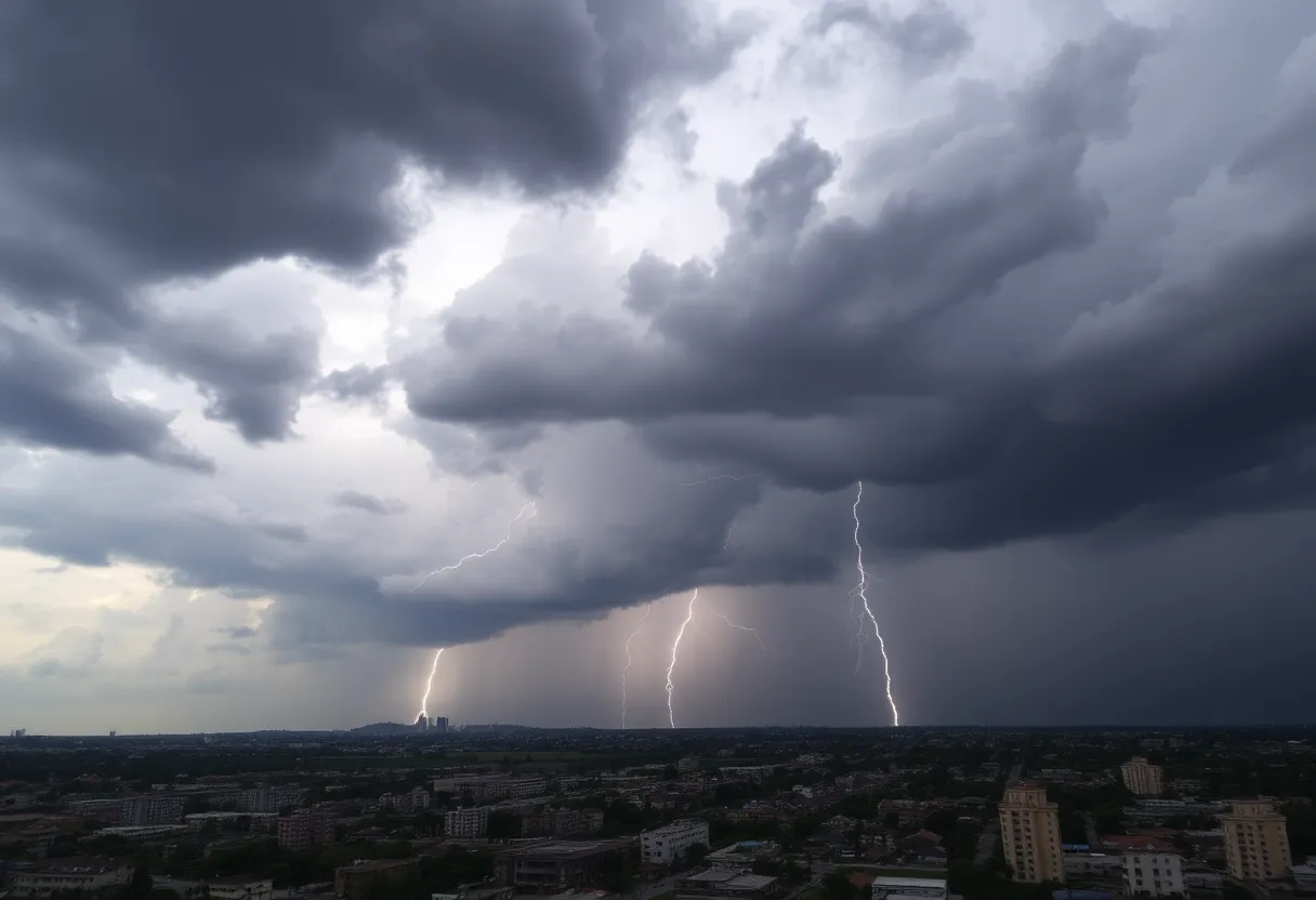
Dark storm clouds gather over the city, signaling severe weather ahead.
Want to target the right audience? Sponsor our site and choose your specific industry to connect with a relevant audience.
Prominent brand mentions across targeted, industry-focused articles
High-visibility placements that speak directly to an engaged local audience
Guaranteed coverage that maximizes exposure and reinforces your brand presence
Interested in seeing what sponsored content looks like on our platform?
May’s Roofing & Contracting
Forwal Construction
NSC Clips
Real Internet Sales
Suited
Florida4Golf
Click the button below to sponsor our articles:
Sponsor Our ArticlesA powerful low-pressure system is set to bring severe weather to the central and eastern U.S. this weekend. With risks of damaging winds, tornadoes, and flash flooding, key cities including St. Louis, Memphis, and Atlanta are on high alert. Meteorologists are monitoring conditions closely, as heavy rainfall is expected to exacerbate flood risks. Stay informed and prepared as storms could impact travel and safety across multiple states.
This weekend, folks in the central and eastern regions of the United States are in for a wild ride! A *powerful low-pressure system* is making its way from the West, bringing with it a **multi-day outbreak of severe weather** that will kick off on Friday and linger into Sunday. So, grab your umbrellas and hunker down, because this could get intense!
When meteorologists talk about severe weather, they mean business! The *Mississippi Valley*, *lower Ohio*, and *Tennessee valleys* are particularly in the crosshairs this weekend. Key cities like **St. Louis**, **Paducah** in Kentucky, **Memphis** in Tennessee, and **Jackson** in Mississippi should be on high alert. These locations are at risk starting Friday afternoon, with thunderstorms moving eastward as the evening unfolds.
What can we expect from this storm? The **primary threats** include **intense damaging wind gusts**, which could blow at speeds of **up to 90 mph**, **potentially EF2 or stronger tornadoes**, and **large hail** that can wreak havoc on property. It’s not just the infamous tornadoes we need to watch out for; the Deep South, particularly **Alabama**, **Georgia**, **Louisiana**, **Mississippi**, **Tennessee**, and the **western Florida Panhandle**, could face the **highest risk** of severe storms. Cities like **Atlanta**, **Birmingham**, **Huntsville**, **Montgomery**, **Chattanooga**, and **New Orleans** are in for a bumpy ride!
One big concern is the potential for **flash flooding**, especially in regions like Alabama, Mississippi, northern Georgia, Tennessee, and Kentucky. Keep your eyes peeled for rising waters and stay informed about local conditions, as heavy rainfall is expected to exacerbate this risk. Thunderstorms could even continue into the morning, affecting parts of the South and creeping northward into the Ohio Valley.
As if that weren’t enough, a *cold front* could lead to additional severe storms by the weekend, expanding the impact to the *mid-Atlantic states* and the Southeast. Cities from **Charleston** in South Carolina to **Raleigh**, **Philadelphia**, and **Washington, D.C.** may see stormy conditions as well. So, if you’re planning a weekend trip in these areas, it might be wise to have a backup plan!
The setup for these storms is quite fascinating scientifically! It includes a **sharp southward plunge of the jet stream** and an influx of moisture from the Gulf. This combination creates a fertile ground for severe storms to develop, meaning meteorologists will be keeping a close watch on this evolving situation.
As the storm rolls through, expect **possible power outages**, **travel delays**, and **hazardous road conditions**. The heavy precipitation and fierce winds can make things tricky if you’re headed out. Interestingly, in advance of this severe weather, many areas have experienced *unusually warm temperatures*, with some states even hitting record highs. Talk about a dramatic shift!
The severe weather advisories could cover almost **half a million square miles** from *Texas* all the way up to the *Dakotas* as the storm progresses. It’s also worth noting that flash floods, dust storms, and critical fire weather risks are on deck in the *Southwest*, primarily due to persisting dry conditions.
So, as we brace ourselves for this potent weather system, remember to stay informed, stay safe, and keep those emergency kits handy. Let’s all do our best to weather the storm together!
News Summary This week brings exciting news from the coastal areas, including new Right Whale…
News Summary The Trump administration's recent announcement to roll back significant climate policies threatens to…
News Summary The search for Sudiksha Konanki, a 20-year-old University of Pittsburgh student, is ongoing…
News Summary The U.S. Department of Education has announced a significant staff reduction, cutting nearly…
News Summary Russia has laid out a series of demands to the U.S. regarding a…
News Summary Dare County has announced a remarkable 67% increase in its property tax base,…